
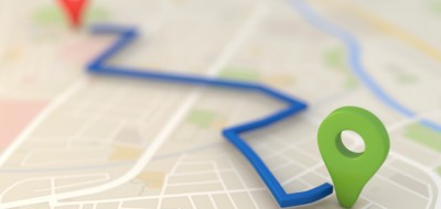
How many times have you heard or said, “You can’t get there from here”? Navigation is key when heading out in an RV. Finding your way can be scary and mysterious; you can and will get lost. And although map reading comes easier to some people than others, road maps and atlases are necessary tools, especially if you do not yet have a Global Positioning System (GPS), or for those times when your GPS access is unavailable or you just want to confirm its directions. Here are some tips to help you stay on the beaten path (as long as that’s where you want to be).
- When you are staying with friends in their driveway, identify a billboard or another landmark to look for to know when to turn onto their street or road. This is especially helpful at night. – Annie Carroll, Panama City, FL
- Learn how to read a road map. The legend on the map will show you what all the different symbols mean. It may indicate scenic routes and exit numbers too. You should also find symbols for rest areas and picnic areas and even campgrounds.
- Before hitting the road in the morning, get out the maps and tour books you’ll want during that day, as well as the campground directory. You’ll be glad to have them handy when a question comes up. GPS users will want to be sure their day’s travel destinations are programmed into their units.
- Keep your map folded open to the relevant section.
- Use a yellow felt tip pen to highlight the next day’s route on your map. This helps the navigator follow the route and give information to the driver as requested.
- Write down the day’s route numbers for the other drivers in your caravan if you are the one who figured out the itinerary. Having information written down makes navigation easier. Discuss and review your notes with the other drivers also.
- Lost? Don’t panic. Look at the map and ask for directions at the nearest fuel station.
- In addition to carrying campground and truck stop directories with you, stop at state welcome centers, talk to campground hosts, and pick up maps of the area and brochures on what to see and do.
- Get a map of each state you will drive through either from your automobile association before you leave home or at the welcome center for that state (where they are free). A state map is usually larger than the page in an atlas and contains more information such as smaller towns. Atlases do come in handy when route planning involves several states at once, and because of their size, they are easy to handle.
- Be sure your state maps show rest areas and exit numbers. This helps you to plan stops as you travel. Some highway signs will tell you the distance to the next rest area. Your GPS may also provide this information.
- Navigators should be able to tell the driver what the exit numbers are so the driver will know when to leave the interstate highway. Also, by knowing the last exit number before leaving some states, you can determine approximately how many more miles you will travel in that state on that highway. For example, in Mississippi, the last exit number for I-10 as shown on the map is Exit 75. As we traveled east on I-10 toward that exit, we passed a sign for Exit 61. We subtracted 61 from 75 and learned that we had about14 more miles in Mississippi.
Enjoy your RVing!
Bernice

Karen
Our motorhome cab came with a digital compass mounted in an enclosure on the ceiling between the seats. We thought that it would be a useless addition , just part of the upgraded package. We love it! We use it constantly to make sure we’re going the right direction ,whether we’re in a city or following some back road. And because we like the tiny roads it really helps. We don’t have to worry about getting lost and driving in circles -as long as we’re going in the right direction , we’re happy.
Nancy
I travel alone so i write out the hwy numbers and where I will make a change of hwy. I write quite large, for quick viewing and put it on a clip board. The GPS really talks to me when I take a route that it hasn’t figured for me but is one I have seen on the map earlier that is shorter or to a place that I want to visit. I keep expecting her to get irritated but she hasn’t so far. I use both tools
Darrel
Hi, probably all good navigation tips but I can’t imagine using a paper map again. I haven’t used a paper map or needed one since I got a GARMIN GPS over 10 years ago. For $235.00 for a GARMIN nuvi 255W using a paper map instead of a GPS is like using a horse and buggy instead of a motorized vehicle.
Tom
Good information, but one thing I wish would be with maps and/or inputed into the GPS is bridge heights
On my last major travel, I wasn’t always on. The interstate & was nervous a few times until I was able to
See the sign displaying the height/clearance.
John Shelton
Good tips, Bernice
A navigator also needs to be aware that most states (if not all by now) number the exits by the last mile marker. (Exit 61 will be between mile markers 61 and 62) This way, if you are passing mile marker 10, for instance, you know that you are approximately 51 miles from exit 61. If you are traveling the other direction, you have to think backward. (I’m passing the 82 mile marker and the markers are counting down in my direction of travel, so exit 61 will be approximately 20 miles away. [between mile markers 61 and 62]) Keeping this information in mind makes rest stops, etc. much easier to plan & manage.
p.s.: the 7th. tip doesn’t apply to men does it???? No. 8 is especially helpful
Jimmy Crumpler
I see the prettest places lost, places I would not see otherwise.