
I’ve had some conversations with fellow RVers that went something like this: “What kind of GPS navigation system do you use as you travel?”, I asked. They responded with something akin to: “I don’t need no stinking GPS to do my navigating! I can read a map just fine.”
hmmm, that got me to thinking. I’ve told many people that I won’t travel without a GPS navigation system anymore, but I love maps too. I can read a map with the best of them and I’ve traveled across this country a few times before GPS was available. So, what *is* it that I like so much, that can’t be done with a paper map?
One day, when we were in Southern California and we were taking a side trip in the car, we didn’t have our laptop with us and so had to navigate the old fashioned way. I knew we needed to turn right on Sweetwater Rd. and I was looking for it. It sure seemed like we had gone too far. Had we passed it? Oh no. How many miles would we need to travel before there was some other road or landmark that would verify if we had missed our turn?
Then I realized, that’s it! With a GPS navigation system, it just takes a glance at the computer screen to know if your turn is still ahead, or if you missed it. When you’re in unfamiliar territory, you don’t know the landmarks. Without a GPS, you have to be constantly vigilant in watching for your turns. With a GPS, you can relax and enjoy the view.
In the short video above, I show you a sample of how we use GPS navigation. What about you? What do you use, if any?
Chris Guld
www.GeeksOnTour.com
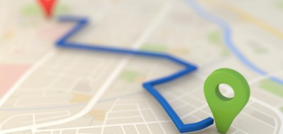
Let the Computer do the Navigating

Darrel
We use a GARMIN of course. They are the leader in GPS. In our RV we use the StreetPilot 7200 most of the time because of the 7” display. We can sell Magellan, TomTom, Furuno etc. but we sell nearly 100% GARMIN because they are the best. The nuvi units are the most popular now for in vehicle navigation and they also have a battery for use on foot as well. Email me at [email protected] if you have any questions about GPS. Thanks.
Angie
I have two. A Magellan for travel and a Garmin for geocaching. Love them both. I can use a map, but why would I want to? I will never travel without a GPS again. The greatest thing since sliced bread. 🙂
Woody
We use TomTom and love it for all the reasons posted in previous comments. We also combine use of paper maps (well I use paper maps) and Microsoft Streets and Tips with our TomTom to plan trips, my wife does the computer thing. It sure does save a lot of stress when travelling in unknown areas and we find it really helps to know exactly how much time to the next destination, which helps with fuel stop decision or even a good stretch break.
Steve White
Our GPS is a rather older model Garmin Street Pilot III and it has been a real asset. I’m sure it has paid for itself many times over in saving us from wrong turns and fumbling around in unfamiliar territory. Last spring, for example, we were following telephone directions given by a vendor and suddenly about 2 miles from the address we ran into a “Road Closed For Construction” sign completely unannounced until we hit the blockage. I asked the GPS to reroute us around the “Detour” (a standard feature) and it did so. We made our appointment with just minutes to spare and never would have made it without the GPS. We use a combination of maps (my wife is the navigator) and our GPS. They work very well together.
Barry
I find knowing the proper lane to be in, the most valuable asset of my GPS. Todays hiways and freeways are so congested, if you happen to be in the wrong lane at a time to exit there is little chance you will be able to move over. My GPS will tell me with plenty of notice if I will need to merge or exit and which lane I will need to be in to do that safely.