During winter, southern Utah’s famed red rock country becomes a land of contrasts as the vermillion cliffs, hoodoos and colorful monoliths get dusted with stark white snow. In this desert winter wonderland, visitors can enjoy some of the most pristine landscapes in the country without overwhelming crowds that flood the parks the majority of the year. Find solace on the trails, drive roads that are usually closed to private vehicles and take advantage of the off-peak prices. However, exploring in winter comes with its own share of challenges; park services are limited, not all sites are accessible and temperatures can get frigid. Before you set off on your adventure, be mindful of the weather forecast; pack plenty of layers and winter hiking gear, and research road conditions to ensure your trip is fun and safe.
Zion National Park
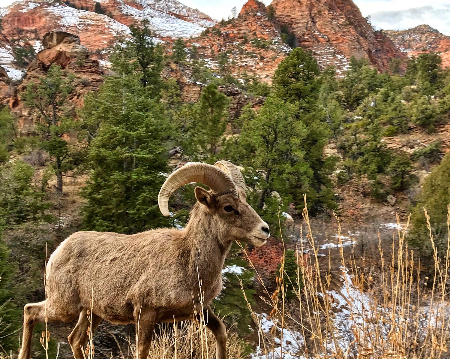
Bighorn Sheep were reintroduced to Zion in the 1970s and are frequently seen between the Mount Carmel Tunnel and the East Entrance.
Considered one of the most majestic national parks in the nation, Zion’s most prominent feature is Zion Canyon, nearly 15-miles long and up to 2,640-feet deep. One of its less attractive features is the crowds, as it’s the third most visited National Park in the country. To beat the 20,000-per-day summer visitors, head to Zion during the winter, where you’ll find plenty of solitude while out on the trails. The other bonus about visiting between December and February is the fact that you can drive to almost all of the trailheads along Zion Scenic Drive, which is closed to private vehicles and only accessed by shuttle buses the majority of the year.
Though evenings are chilly, daytime temps hover in the 50s, providing comfortable weather for strenuous hikes. Luckily, Zion Canyon’s low elevation means snow rarely makes it to the floor, and if it does, it quickly melts. However, on the peaks and higher elevations, expect snow and ice.
Lake Powell
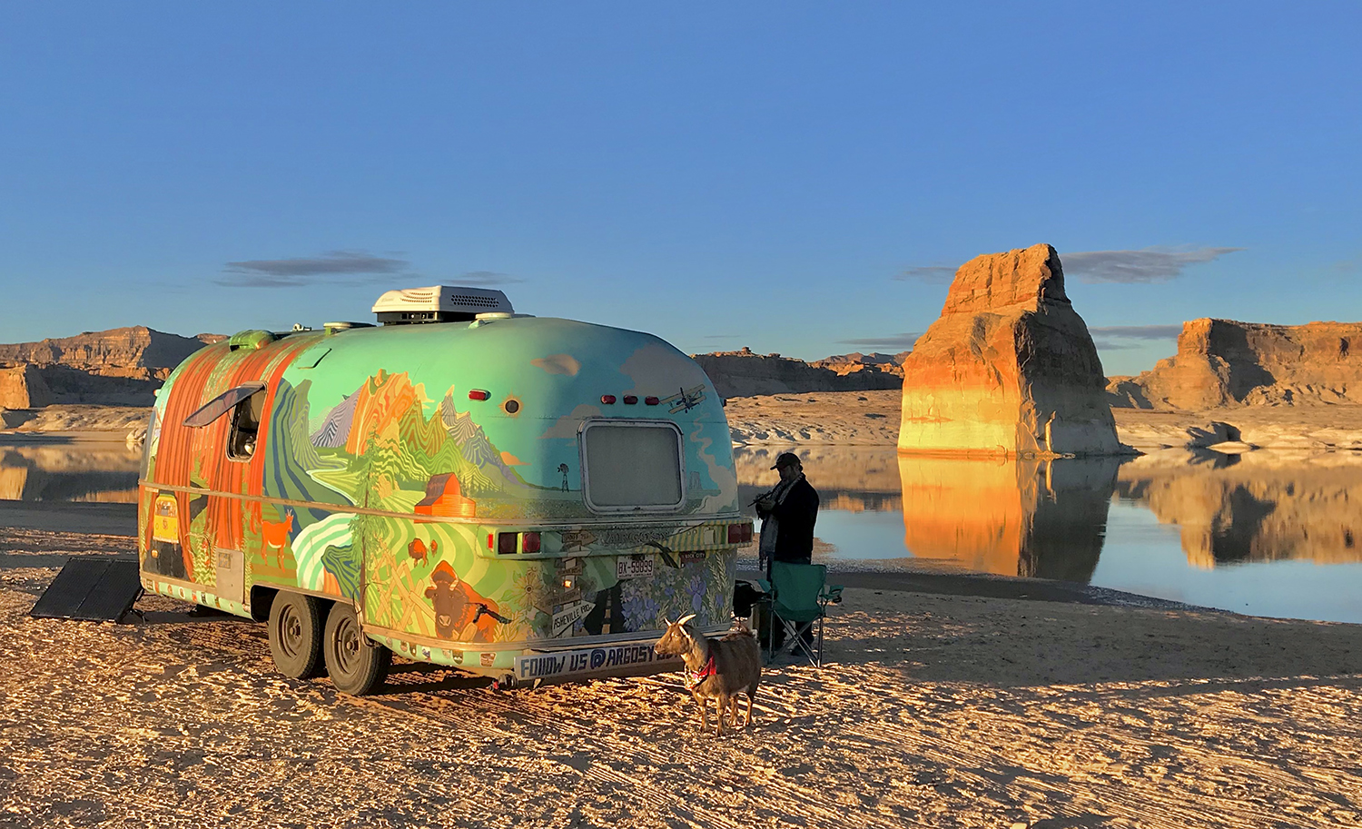
Frankie, our faithful watch goat, stands guard at our trailer parked at Lone Rock Beach on Lake Powell.
Straddling the border of Utah and Arizona, Lake Powell and the greater Escalante area makes the perfect basecamp for winter adventures. Unlike summer, which sees its most visitors, winter is an ideal time to visit the lake where the water is calmer, the fishing is better and the cooler temperatures allow for longer hikes. Take a boat tour to Rainbow Bridge National Monument, one of the world’s largest known natural arches, or rent a powerboat at the marina to explore Glen Canyon. For pet-friendly hikes, take the short walk to Horseshoe Bend outside of Page or hike along the Toadstool Hoodoo Trail near Big Water. If you don’t mind tight spaces, book a tour of Antelope Canyon, one of the most photographed slot canyons on Earth. For the best view of Lake Powell, take the scenic but bumpy drive to Almstrom Point, which rewards visitors with panoramic views of Lake Powell.
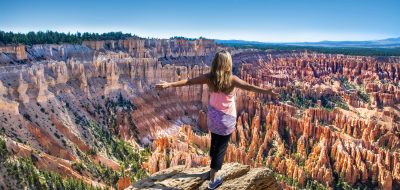
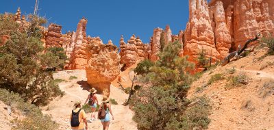
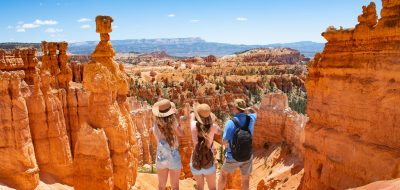
Bryce Canyon National Park

Plan to catch the sunrise at Sunrise Point for the best views of Bryce Canyon National Park.
It can be said that Utah’s smallest national park could also be its prettiest. During the winter, this unique high-elevation park turns into a winter wonderland as snow covers its vibrant hoodoos. The rich reds juxtaposed with the stark white snow is a photographer’s dream, but you will have to put up with frigid temperatures. During the day, wintertime highs only reach about the mid-thirties and nights get well below freezing — so pack plenty of warm clothes, traction cleats or snowshoes to explore the trails. While visiting Bryce, take the 18-mile scenic drive from the Visitor Center to Rainbow Point, stopping at the many overlooks including Bryce Natural Bridge. Take the 3-mile hike along the Navajo Loop and Queen’s Garden Trail that passes through some of the most iconic scenes at Bryce Canyon. For those interested in photography, catch the sunrise at the aptly named Sunrise Point and watch the geological amphitheater aglow with morning’s first light. If you are traveling with pets, like other national parks, Bryce trails are mostly off-limits, except for the Rim Trail between Sunset Overlook and Sunrise Overlook. To take Fido on a longer hike, head down the road to the pet-friendly Red Canyon, where you’ll find plenty of trails to roam.
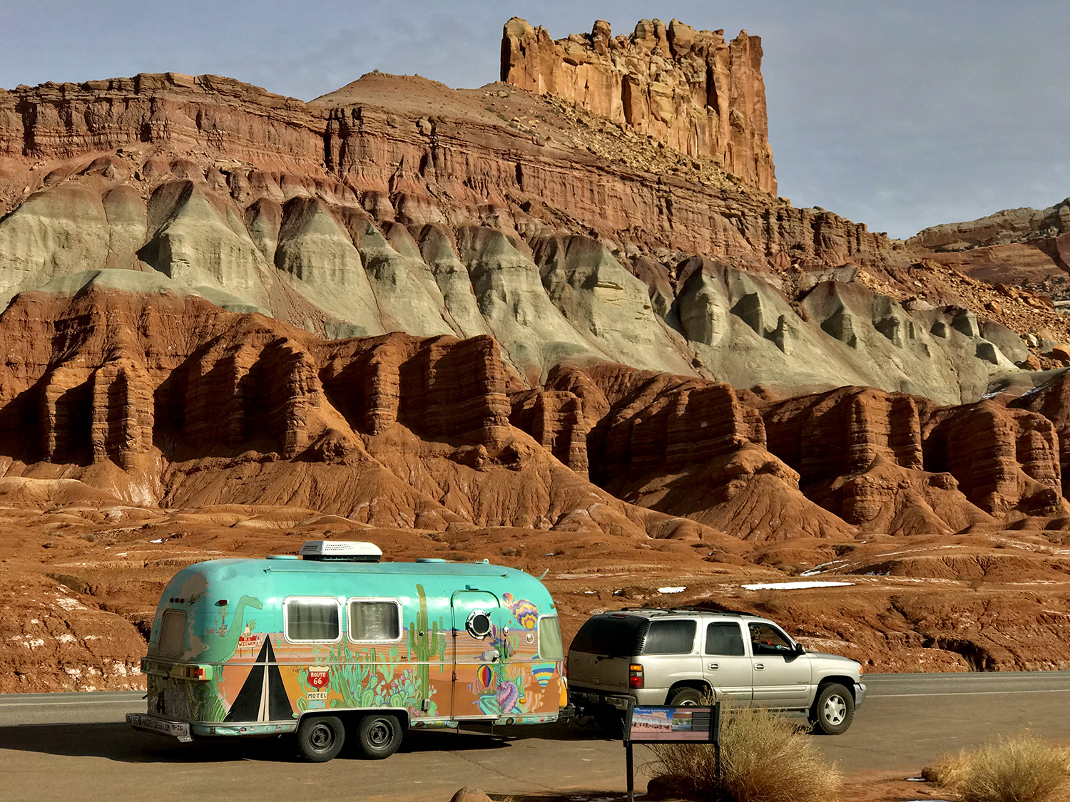
Capitol Reef National Park
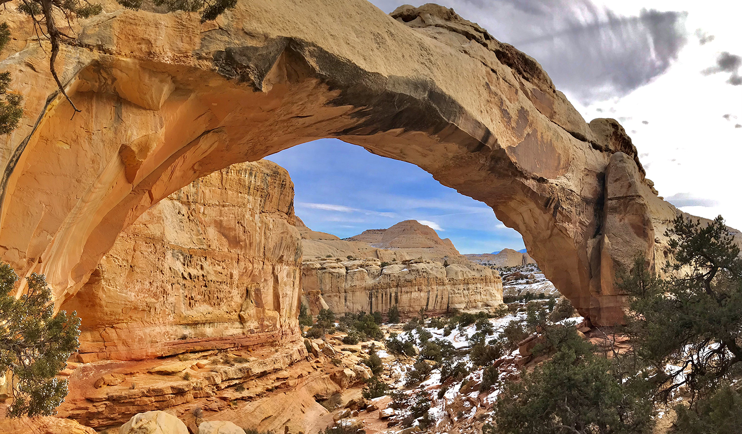
Hickman’s Natural Bridge is a short and easy hike at Capitol Reef.
Perhaps one of the country’s most underrated national parks, Capitol Reef is a hidden treasure within red rock country, filled with canyons, domes, cliffs and natural bridges. Its most prominent feature is the Waterpocket fold, essentially a 100-mile long wrinkle in the earth’s crust caused by multiple tectonic uplifts and erosion. The park has a rich history of its early inhabitants. Capitol Reef’s indigenous people date back over 10,000 years, as there’s evidence of cave shelters, spears, woven nets and stone tools. Roughly 2,000 years ago, the Fremont culture and Anasazi called the area home, where they irrigated crops of maize and squash and stored them in stone granaries. They also left behind written testimony of their hunts and lifestyle, which can be viewed at the petroglyph panel along highway 24. In the 16th century, the Ute and Paiute tribes occupied the area before early Mormon settlers made their way to Capitol Reef. Today, you can visit several historic sites located right off the road, including the Fruita Schoolhouse, cabins and orchards. While exploring the park, take the 7.9-mile paved Scenic Drive that stays open year-round, and if weather and conditions permit, the two dirt spur roads; Grand Wash and Capitol Gorge. For some short hikes, follow the trails to Hickman’s Natural Bridge or Cassidy Arch, and for a longer trek, explore the Grand Wash trail. While hiking in winter, don’t be surprised to see bighorn sheep, mule deer, eagles and foxes while exploring the park. In the winter, you don’t have to worry about snakes, as they hibernate until spring.
Goblin Valley State Park
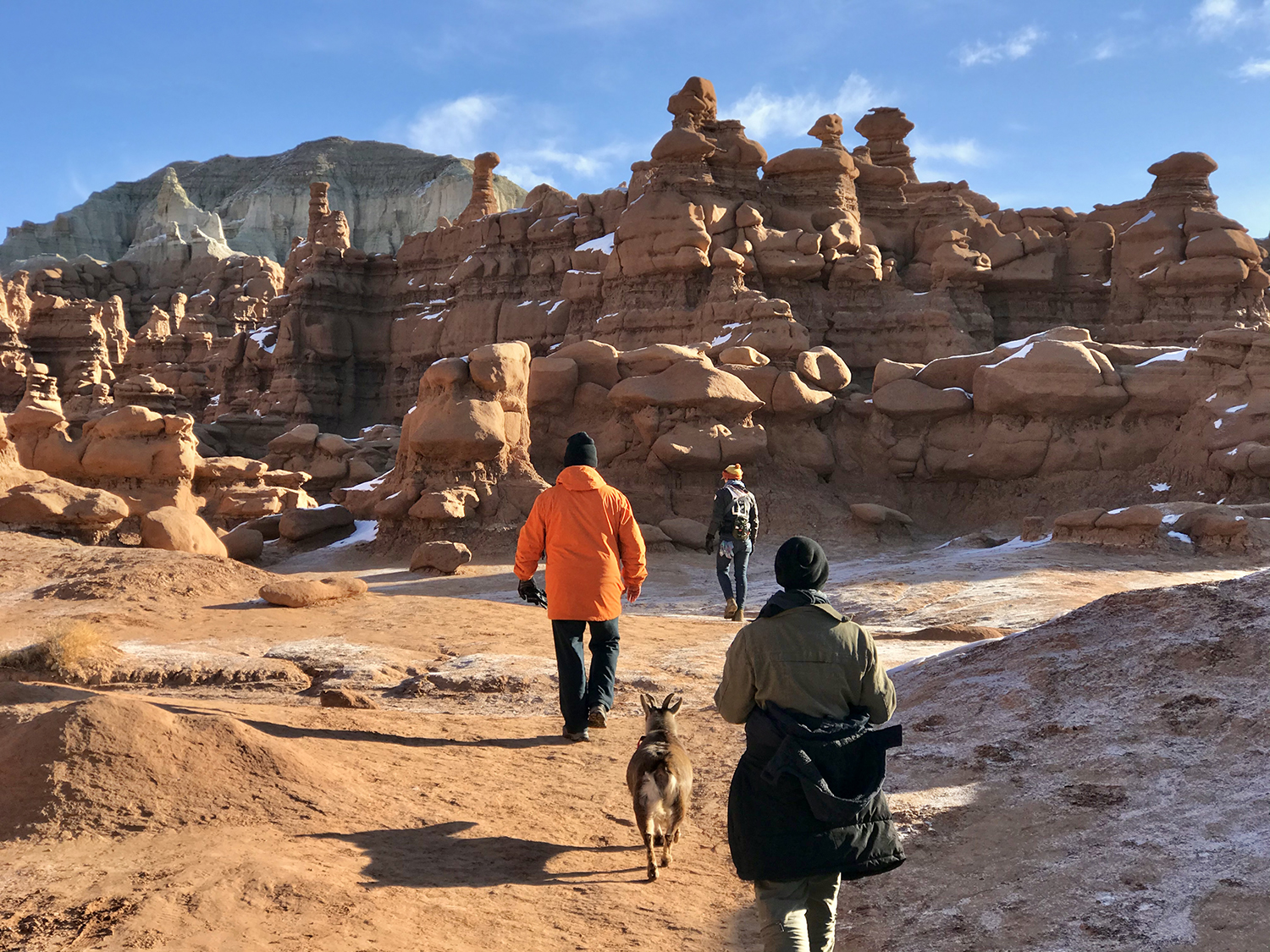
Exploring the labyrinth of rocks at Goblin Valley.
One of the best-kept secrets of South Central Utah is Goblin Valley, a perfect stop between Capitol Reef and Moab. You’ll understand where it gets its name as soon as you see the thousands of goblin-shaped hoodoos that cover the valley floor. This pet-friendly state park is a choose-your-own-adventure kind of place, so wander through the labyrinth of rocks as you wish, as there are very few actual designated trails. While there, you can also explore the “Goblin’s Lair,” a cavernous slot canyon that requires a little bit of scrambling. Besides hiking, you’ll find great biking trails and an excellent disc golf course close to the campground. For those interested in boondocking, there are ample spots along the road to camp just outside of the park boundary.

You can avoid the extreme summer heat by exploring Little Wild Horse Canyon during the winter.
Just two miles down the road from Goblin Valley is Little Wild Horse Canyon, an impressive slot canyon in the heart of the San Rafael Swell. This pet-friendly BLM-designated loop trail can be hiked in its entirety or as a shorter out-and-back trail that passes the most dramatic part of the canyon.
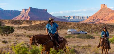
Moab

Colorful mineral-rich hills can be found around Moab, perfect for rockhounding.
When it comes to outdoor recreation, Moab is a mecca for adventure. Within an hour of downtown, you can be exploring Arches National Park, Dead Horse Point State Park, and Canyonlands National Park. Additionally, the area is known for its dinosaur track sites and some of the world’s largest collections of petroglyphs, including Newspaper Rock and the Great Gallery. Though winter is its quietest season, Arches National Park is by far the most attended park in the area, so plan to explore midweek or early during the day to beat the crowds. While visiting, enjoy the world’s largest proliferation of natural bridges, including more than 2,000 recorded arches within the park’s boundaries. During the off-season, most hiking trails remain open; just remember to bring traction devices or trekking poles for the snow and ice. For iconic views of the park, take the trail to Delicate Arch, Double Arch or Landscape Arch and drive the auto tour along Arches Scenic Drive, passing by Park Avenue, Double Arch and Balance Rock.

Newspaper Rock, near Canyonland’s Needle District, is an impressive collection of petroglyphs you can see right along the road.
Unlike Arches, Canyonlands National Park is spread out into four districts, each offering different opportunities for sightseeing and adventure. The closest to Moab is the Island in the Sky district, situated between the Green and Colorado Rivers and adjacent to Dead Horse Point State Park. There, you’ll find expansive overlooks and a multitude of hiking trails. Along the scenic drive, take the short trail to Mesa Arch, one of the most photographed features of Canyonlands National Park. For a more backcountry experience, take a day trip or plan a multi-day excursion to the Needles District, about a 2-hour drive from Moab. Named for the colorful spires of cedar mesa sandstone, Needles offers visitors plenty of solace, as it receives far fewer visitors than Island in the Sky. While there, explore the old Cave Springs Cowboy Camp. Take the short hike to Pothole Point or the longer trail to Chesler Park Viewpoint. The Maze District is even more remote than Needles and requires four-wheel drive and high clearance, while the Rivers District can only be accessed by boat.

Mesa Arch provides stunning views of the canyon below.
Dead Horse Point State Park, best known as the setting for the iconic ending scene in Thelma and Louise, is an easy drive from Moab and is on the way to Island in the Sky. Located on a 2,000-foot-high mesa, the park offers great hiking trails and jaw-dropping panoramic views of the river canyon below. While visiting, take the East and West Rim trails and catch the sunset or sunrise.
Valley of the Gods
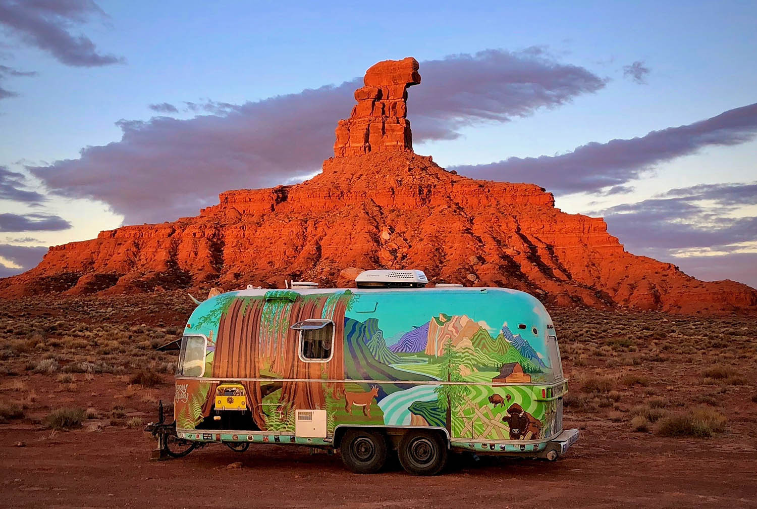
Red rocks are aglow during the first and last light of day.
Located in the Southeastern portion of the state, Valley of the Gods is the less populated yet equally stunning neighbor of Monument Valley. Situated near Mexican Hat, the area dazzles with its colorful freestanding monoliths, spires and buttes rise high above the valley floor. The formations are considered sacred to the Navajo, who interpret the rocks as being ancient warriors frozen in stone. While exploring Bears Ears Country, take the 17-mile unpaved scenic drive through the Valley and Moki Dugway if weather and conditions permit.
While in the Mexican Hat area, plan a visit to Gooseneck State Park, where the San Juan River has carved a series of tight turns in the canyon, exposing nearly 300 million years of geological history. Soak up the night sky and the panoramic vistas of the river below.
For those who want to see where Forrest Gump turned around during his trek across the country, Monument Valley is a short drive across the border into Arizona and the pull-off is around mile 13 along Highway 163.