


West of the Cascades might get all of the glory, but Eastern Oregon rivals the rest of the state with its own unique beauty — and without the crowds. It’s a land of extremes, from the deepest river gorge in North America to the highest road in all of Oregon; this region is full of surprises. Crackled playas, painted hills, soothing hot springs, and snow-capped peaks lay claim to the land east of the Cascades, offering visitors the chance to witness spectacular scenery, wildlife, and world-class adventures.
Hells Canyon

A mountain goat perched above Hells Canyon. Photo Credit: Cate Battles
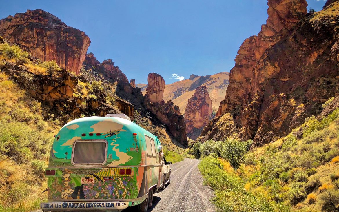
Tucked away in the Northeastern corner of the state, Hells Canyon offers up a unique slice of Heaven. North America’s deepest river gorge straddles the border of Eastern Oregon and Idaho and is nestled beneath the jagged Seven Devils mountain range. At 7,900 feet in depth and 10 miles wide, this geological giant has got the Grand Canyon beat by almost 2,000 feet. The rugged wilderness within Hells Canyon National Rec Area offer numerous outdoor recreation opportunities, along with wildlife viewing and the chance to explore artifacts from the past.
Driving down Hells Canyon Road from the unincorporated town of Oxbow, the towering walls of the gorge climb higher and higher as the road meanders along the Snake River until reaching the Hells Canyon dam and Visitor Center. While there, hike along the Stud Creek trail to see the canyon from below or take the Hells Canyon Scenic Byway, a 213-mile loop, that takes you up along the rim. Get a birds-eye view at the Hells Canyon Overlook and at Hat Point, where you can scale the 60-foot lookout tower. During your stay, enjoy a jet boat tour through the canyon or a multi-day rafting trip for the more adventurous. Hells Canyon is also a popular fishing destination, where you’ll find a diverse array of aquatic life including steelhead, sturgeon, salmon, and bass. Along the shore, bears, big horned sheep, chukar, elk, and mountain goats call the canyon home.
Campground nearby:
Alvord Desert
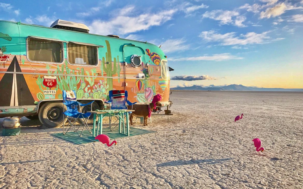
Frankie the Flamingoat taking in the vast views of the Alvord Desert. Photo Credit: CatecBattles
Hidden in the rain shadow of Steens Mountain, this cracked desert landscape is one of the most isolated and unique geographical features of Eastern Oregon. The 12-mile long and 7-mile wide desolate playa is actually an ancient alkali lakebed that remains dry from summer to late fall. The snow-capped Steens Mountain at the edge of the desert juxtaposed with the barren playa 5,000 feet below is like a sight out of a sci-fi movie—and the perfect playground for those seeking an adventure.
Below the cracked earth, tectonic activity is responsible for not only the uplifting forces that formed the towering Steens, but also several geothermal springs in Eastern Oregon. Located on the edge of the desert, just north of the town of Fields, Alvord Hot Springs is an excellent place to relax and have a soak after a day of exploring. The water gets pumped out of the ground at a scalding 170 degrees but cools off to a human-friendly temperature when it reaches the concrete pools. Free 24hr access to the pools are included when you stay or camp or $10 for non-guests. The Alvord Hot Springs resort also offers easy access to the desert, or folks can use the primitive (and often bumpy) roads nearby. Camping is legal and free on the playa, just keep in mind the heat is extreme in the summer and to be aware of the weather and conditions, so you don’t get stranded. Camping closer to the edge where the earth is drier is advised.
Campground nearby:
Hart Mountain Antelope Refuge

Cate enjoying Antelope Hot Springs at camp. Photo Credit: Cate Battles
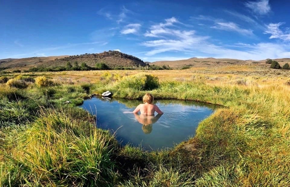
When most people think of antelopes, they conjure up visions of the grazing creatures of the Serengeti; however, here in Oregon we have the graceful pronghorns – North America’s fastest land mammal. Located in Southeastern Oregon’s Lake County, Hart Mountain Antelope Refuge is the perfect place to find solitude while enjoying hot springs, rock hunting, wildlife viewing, and hiking panoramic trails lined with petroglyphs.
This secluded wildlife preserve is home to over 340 species as well as a wide array of geographical features, including: deep canyons, piney forests, craggy cliffs, sagebrush grasslands, and lakes and marshes. One of the best views from this 278,000-acre wilderness can be found at Warner Peak, the area’s highest elevation, situated at 8,071 feet. From there, you can look down at the wetlands below.
One of the most sought-after features of Hart Mountain, is Antelope Hot Springs, located in the free Hart Mountain Hot Springs Campground. There are a couple different springs to choose from, including a semi-improved pool that offers more privacy or a primitive pool that gives you views of the surrounding hills. While visiting the reserve, you’ll find plenty of mineral mines where you can hunt for Eastern Oregon opals and sunstones, near the community of Plush. While hiking Hart Mountain, take the Petroglyph Lake Loop Trail that circles a lake lined with 65 panels of petroglyphs, some of which are dated back 10,000 years.
Campground nearby:
Wallowa

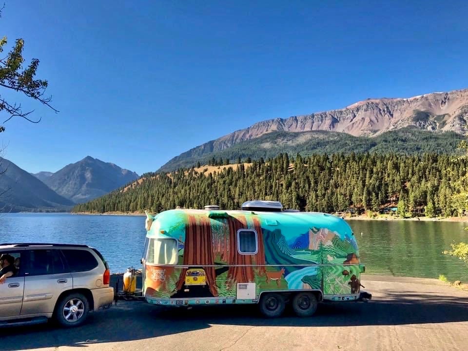
Wallowa Lake offers beautiful views of the mountains. To get a birds-eye view, take the Wallowa Lake Tramway. Photo Credit: Cate Battles
Nicknamed the “Oregon Alps”, the Wallowa’s can be found tucked away in the northeastern corner of the state. Strewn with beautiful old barns, snow-capped peaks, and glistening lakes decorated with wildflowers – this region of Eastern Oregon is a sight for sore eyes.
Long before Louis and Clark arrived in Oregon or white settlers took the treacherous Oregon Trail West in search of land and gold, the Wallowa Valley was inhabited by the Nez Perce tribe for over 11,000 years. At the base of the Wallowa’s is the town of Joseph, named after Chief Joseph, a famous leader of the tribe and whose burial site can be found near Wallowa Lake. Downtown Joseph, located just a few minutes from the lake, has a lot to offer, especially for a town of 1,000 fulltime residents. Between history and culture museums, art galleries, local shops, and restaurants, there are plenty of things to walk around and see, including their famous bronze statues. When you’re done checking out Joseph, head over to the neighboring town of Enterprise and stop at Terminal Gravity Brewing & Pub, a pet-friendly spot where you can spread out on their lawn and enjoy some food and beer.
What really makes Wallowa Country special is their outdoor recreation opportunities. Eagle Cap Wilderness is nestled in the heart of the Wallowa Mountains, offering 360,000 acres of granite peaks, wildflower-painted meadows, and alpine lakes. This area receives a good bit of snow, so the best time to visit is summer through fall.
Campgrounds nearby:
Painted Hills and John Day Fossil Beds
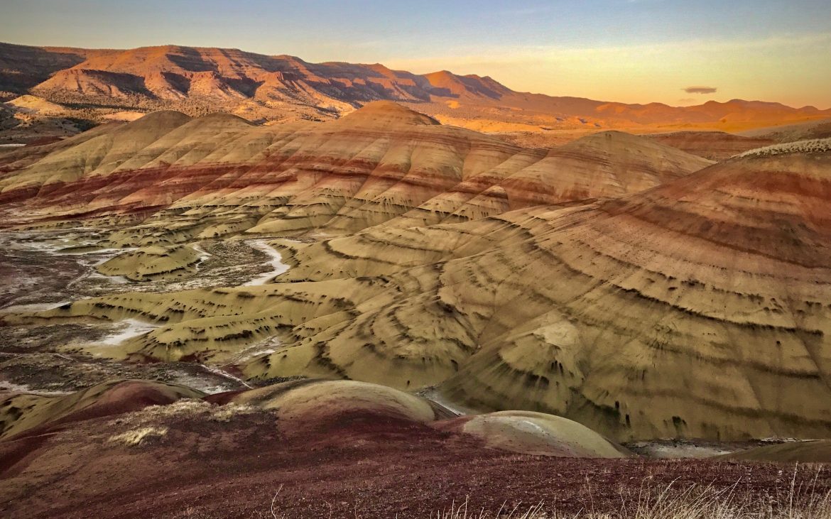
Sunrise and sunset are great times to capture the Painted Hills color. Photo Credit: Cate Battles
Listed as one of Oregon’s “Seven Wonders”, the Painted Hills offer up a splash of color in an unexpected landscape. Boasting colorful patterns of terra cotta red, yellow ochre, and mars black, you’ll feel like you’ve been transported to another planet.
The Painted Hills are one of three units that comprise the John Day Fossil Bed Monument, near the town of Mitchell. Dating back to about 35 million years ago, the area has gone through several transformations, and the bands of color represent unique geological eras. From tropical climates, to cold and arid periods, volcanic ash and plant matter have helped create these colorful banded hillsides. While visiting the Painted Hills unit, there are a few short interpretive trails that are easily accessible or you can take a longer hike along the Carroll Rim Trail, which follows the ridgeline to a viewpoint that’s 2.6 miles, round-trip. While visiting Mitchell, a town of only 100 residents, make sure to visit Tiger Town Brewing Company, that offers a full bar as well as a delicious menu.
Though the Painted Hills are the main attraction of the John Day Fossil Bed Monument, the other two units are worth checking out too. The Sheep Rock unit serves as the hub of the monument, where you can find the main visitors center as well as several interesting points of interest, including Blue Basin, the historic James Cant Ranch, and Mascall Overlook. The Clarno unit is near the town of Fossil, Oregon and features the Palisades, jagged geological formations created from volcanic mudflows that preserved a diverse assortment of plants and animals that inhabited the area.
Campgrounds nearby:
Steens
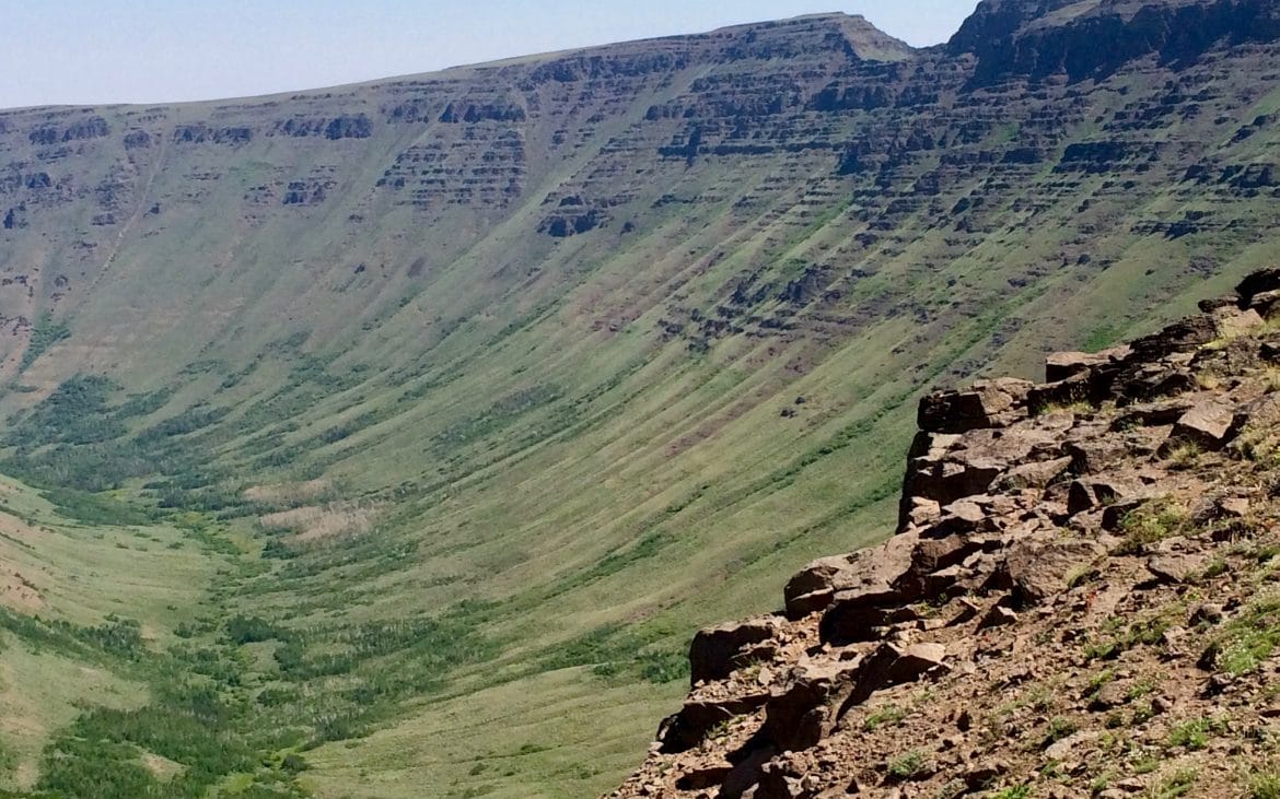
One of the most iconic views of Steens is the Kiger Gorge Overlook. Photo Credit: @TommiDrake
Often mistaken for a chain of mountains, Steens is actually one massive basaltic monolith, stretching 60 miles from the Northeast to the Southwest and 18 miles wide. At its highest point, this glacially-carved peak reaches 9,773 ft, making it Oregon’s 8th tallest mountain. Some of its most striking features include a series of gorges, layered basalt walls, and alpine lakes, creating a beautiful backdrop for a wilderness getaway.
Home of Eastern Oregon’s highest mountain road, the Steens Mountain Loop is one of the most spectacular routes in the state. Heading from the tiny community of French Glen, the 52-mile loop road takes you on a tour of majestic gorges and vast panoramas. It starts off at the southern end of the Malheur Wildlife Refuge, as the road follows the Donner and Blitzen River through the marshland dotted with migrating birds. It passes French Glen; a historic micro-town founded by ranchers in the late 1800s and gradually begins to climb towards the wilderness. After passing Fish Lake, you’ll arrive at the impressive Kiger Gorge Overlook, where you can witness the work of glaciers long ago. Continuing on, stop at the East Rim Overlook, a mile-high cliff that looks over the expansive Alvord Desert below. The last major stop is Wildhorse Lake, a high-altitude lake located in a glacial cirque, where you can enjoy the view from the overlook or take the 2.5-mile round-trip hike to the lake below and swim.
The best time to visit Steens is July-October. While driving the Steens Mountain Loop Road, remember to grab plenty of gas and supplies while in town because this is one of the most remote areas in Eastern Oregon. Though it is a wide gravel road, it can get bumpy in places, so leave the RV at camp.
Campground nearby:
Leslie Gulch and Owyhee Canyonlands
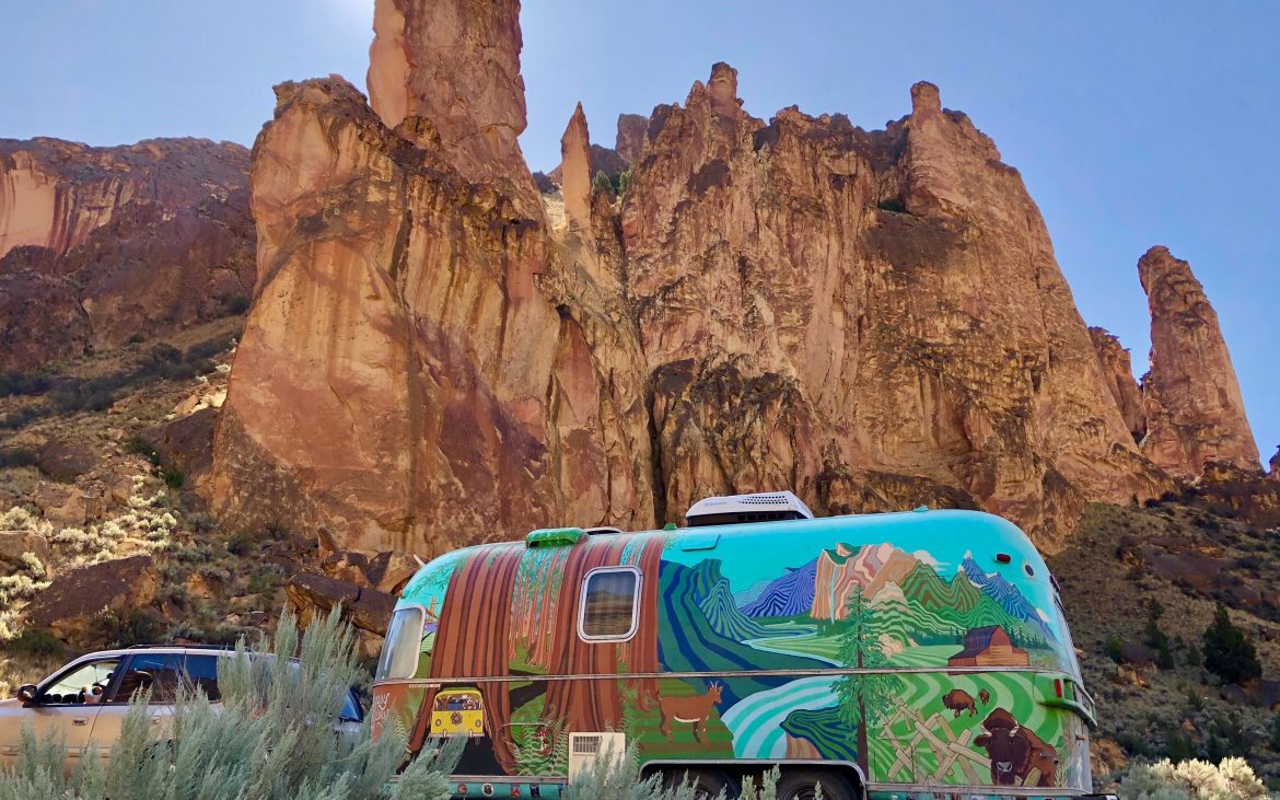
Huge red rock spires tower over the road to Sucor Creek Campground. Photo Credit: Cate Battles
You don’t need to travel to Southern Utah to see honeycombed canyon walls, ancient petroglyphs, or redrock spires; we’ve got that here in Southeastern Oregon. Leslie Gulch Wilderness Study Area, part of the Owyhee Canyonlands, was created from volcanic explosions over millions of years, leaving behind ash and rock fragments that have slowly eroded over time.
Located near Jordan Valley, the long gravel road leading to Leslie Gulch and the free Slocum Creek Campground takes you through beautiful farmland and rolling hills before entering the towering canyon. The drive is spectacular, and you’ll pass several interesting rock formations before arriving at the campground, located within walking distance of Owyhee Reservoir.
Designated as “Wild and Scenic”, the Owyhee River is a tributary of the Snake River and is a favorite spot for rafters. The canyonlands are known for their deep canyon walls, riverside hot springs, colorful hillsides, and ancient petroglyphs. While staying in the area, make sure to visit Pillars of Rome in Jordan Valley and take a daytrip to Silver City, a well-preserved ghost town situated just over the Idaho border.
Campgrounds nearby in Eastern Oregon:
Crack in the Ground and Christmas Valley
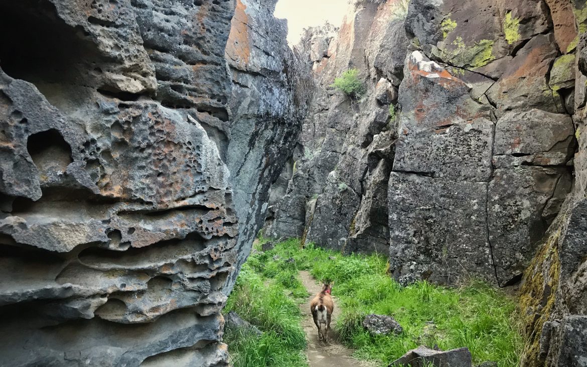
Frankie enjoying the lush bottom floor of the volcanic fissure. Photo Credit: Cate Battles
Christmas Valley is one of those remote places even most Oregonians have never visited. While driving through this unincorporated town, you’ll notice all the streets have names like “Jingle Bell Road” and “Mistletoe Lane”, but this high desert region has more sagebrush than evergreen forests. Christmas Valley is an “off-the-radar” region known for it’s volcanic geology and natural attractions, including deep fissures, craters, sand dunes, and lava fields. One of the coolest places is called “Crack-in-the-Ground, where you can take a 2-mile hike inside an ancient volcanic fissure. This 70ft deep crevasse offers hikers relief from the summer heat with its 20-degree cooler temperature at the bottom floor.
Fort Rock, a near-circling rock wall, measuring 4,460 ft. in diameter is a volcanic landmark and an archeological site where they’ve found evidence of North America’s earliest people. This volcanic tuff ring was formed by explosions of hot magma that met cold groundwater during the last Ice Age. Down the road from Fort Rock, you’ll find “Hole-in-the-Ground”, another volcanic landmark that was created when Basaltic magma intruded at the surface of the ancient lake, which in turn, created enough steam to cause an explosion leaving a mile-wide crater in it’s place. The area is also home of the Christmas Valley Sand Dunes, a public dune complex covering 11,000 acres. The dunes are up to 60 ft. high and are composed of mostly ash and pumice left behind from Mount Mazama’s explosion that also formed Crater Lake 7,000 years ago.
Campground nearby:
Smith Rock State Park

The River Trail follows the meandering Crooked River at Smith Rock. Photo Credit: Cate Battles
Northeast of Bend, and situated just outside Terrebonne, Smith Rock State Park is an outdoor adventurer’s playground, and a popular spot for avid hikers and rock climbers. Towering volcanic ash spires rise above the sagebrush desert as the Crooked River winds through its canyons. For an easy hike, take the River Trail to Monkey Face, an iconic rock formation that unsurprisingly looks like a primate. For a more challenging trail, hike up to Misery Ridge and enjoy views of the Cascade Range to the West.
This pet-friendly park is home to numerous birds and wildlife including bald and golden eagles, peregrine falcons, as well as mule deer and river otters. Known as offering sunshine 300 days out of the year — an accomplishment anywhere in Oregon — the park is an excellent place to visit fall through spring, as the summer can prove pretty hot.
Campgrounds nearby:
Pete French Round Barn and Malheur Wildlife Refuge
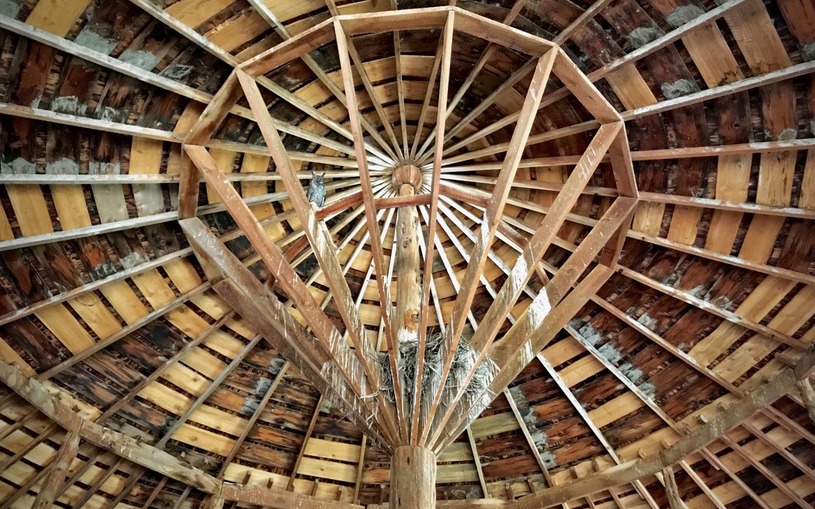
A barn owl stares down from the rafters at the Pete French Round Barn. Photo Credit: Cate Battles
Situated between the town of Burns and Steens Mountain, the Malheur National Wildlife Refuge encompasses 187,000 acres of wetlands and meadows that are home to over 340 avian species and 67 mammal species in Eastern Oregon. This mecca for wildlife enthusiasts is one of the most important bird habitats in the country and is a premier spot for birdwatching. While there, take the auto tour along the 42-mile gravel road that offers prime wildlife viewing and interpretive opportunities on the Refuge. Along the way, stop at Diamond Craters, a series of craters, cinder cones, and lava flows.
One of the most impressive features of the area is the Pete French Round Barn, a 19th century enclosed corral constructed for Pete French, known as “Oregon’s Cattle Baron”. The barn was built to train ranch horses during the harsh winter months and is truly an architectural wonder. While visiting this state heritage site, don’t be surprised to see the resident barn owl staring down at you from the rafters.
Campgrounds nearby:
Find more great Good Sam RV campgrounds in Eastern Oregon here.
For more tips on how to find the campground that’s right for you, check out our comprehensive guide for finding the right campground.